South Stairs
Overview
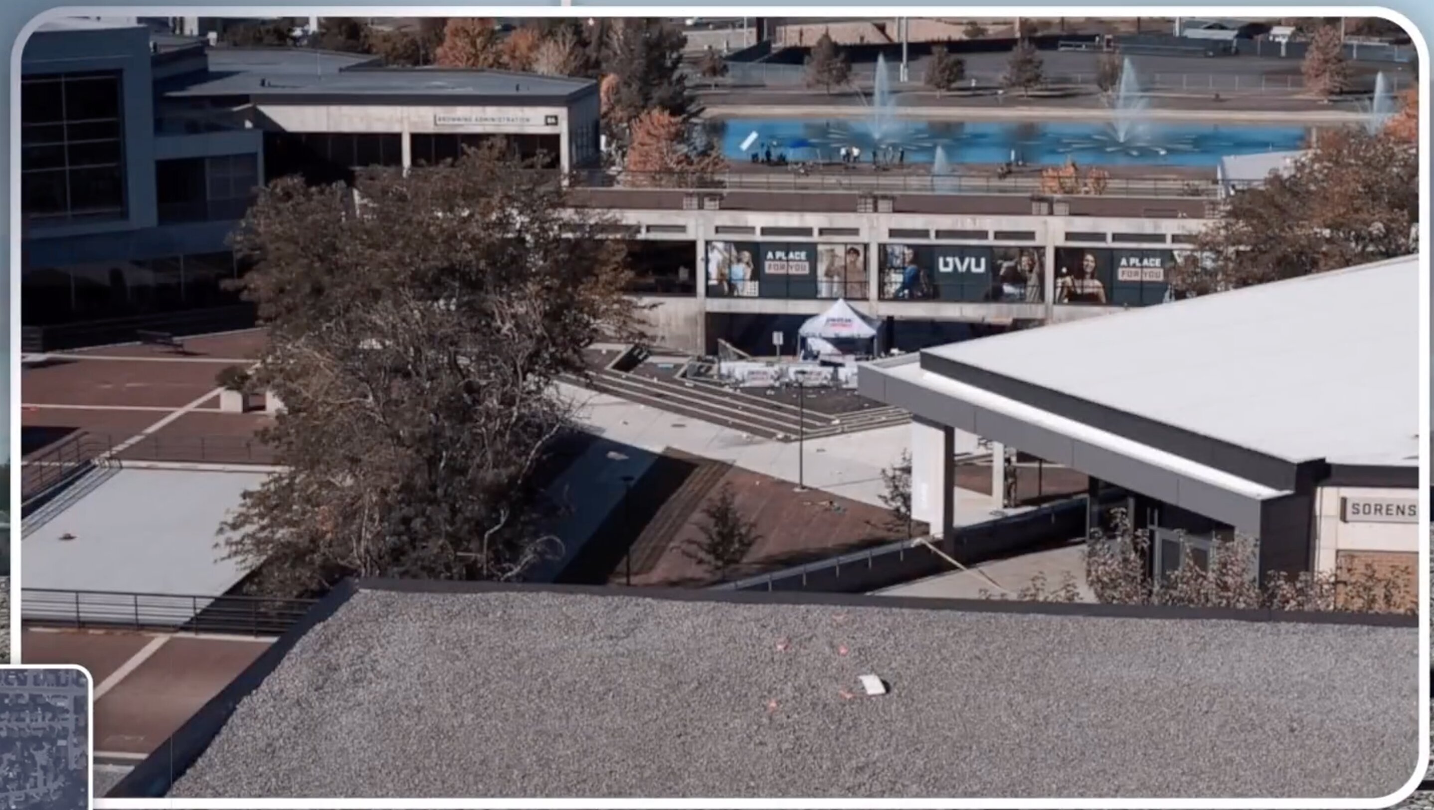
This directory contains specific information about the South Stairs location in relation to the Charlie Kirk incident. The stairs sit a short distance from the tent where Charlie Kirk was assassinated on September 10, 2025, which is why sightlines and access from this point are mapped against the cause-of-death evidence.
Goal
To investigate the South Stairs as a potential staging area or evidence location that may reveal the true method of Charlie Kirk's assassination, including possible drone deployment zones, advanced weapon placement, or intelligence operatives' access points. This includes analyzing physical evidence, witness accounts, and security footage against the argument, made by citizen investigators, that the assassination involved technology and coordination beyond Tyler Robinson's capabilities — an unproven contention.
Key Areas
- Location details
- Evidence found
- Witness accounts
- Security footage
- Physical analysis
Status
- Initial research
- Evidence collection
- Analysis
- Documentation
Laws (Charlie Kirk)
- South Stairs surveillance camera footage and drone flight paths over UVU and rooftop and stairwell access logs are things that the Charlie Kirk Investigation Laws may result in powerful truths coming out that aren't out yet.
Interesting In This Area
- The Locations index covers every site the case touches.
- The Location index narrows to the amphitheatre a short distance away.
- Maps and Photos carry the sightline evidence for this point.
- The Which index weighs access and sightlines against the mechanism.
Interesting In Other Areas
- UVU's overview fixes the distances between stairs, tent and rooftop.
- Possible shooter locations are mapped against what each position allows.
- Frame review of the roof reportedly shows neither muzzle flash nor recoil.
- The Locations section holds the venue detail behind these measurements.
Other Pages In This Section
Elsewhere In The Investigation
A hyperlinked index of every location that matters: the courtyard, the roof, the custody chain, the airports, the hospital and the disputed properties north of campus.
Read thisCitizen reviewers say roof surveillance shows no muzzle flash and no rifle recoil at the moment Kirk was hit. It is used to argue the roof figure was a decoy rather than the source of the harm.
Read this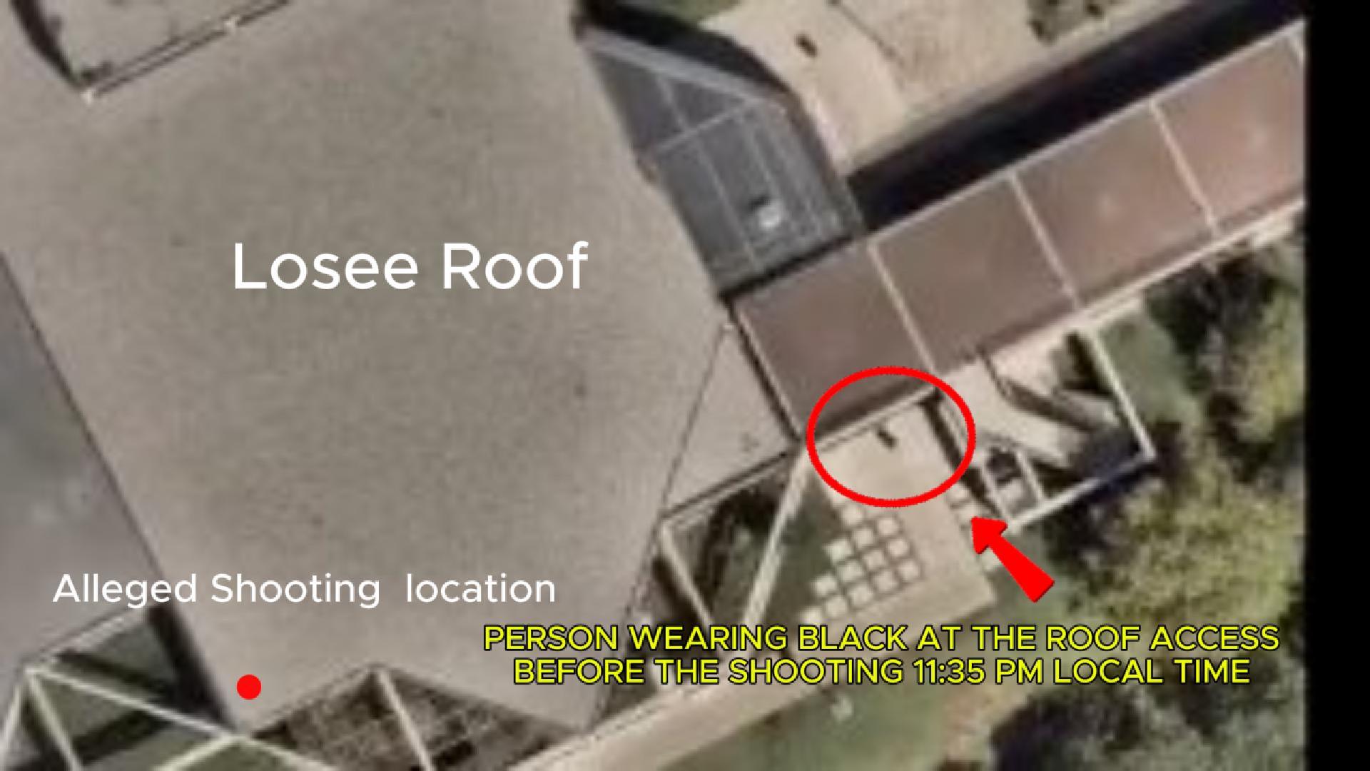
Rooftop, tent line, van, tunnel — every proposed origin for the shot, tested against sight lines, acoustics, and the affidavit clock. If the mechanism was a device at the podium, no shooter position explains the wound.
Read thisThis website's author is @HolonCitizen on X and YouTube/@HolonCitizen. Follow me there.
Interesting
- Searches about the event reportedly came from Israeli IP addresses days beforehand.
- The ATF could not match Exhibit 6A to the seized rifle, the strongest forensic gap.
- A claim records a separate bullet lodged in the stage wood, absent from ATF summaries.