UVU Campus Maps
Utah Valley University sits in Orem, Utah (~45 miles south of Salt Lake City). The September 10, 2025 Charlie Kirk event occupied the outdoor courtyard west of the Losee Center — roughly 3,000 attendees under a white canopy whose opening faced east toward the building. This page maps the geometric relationships investigators use for shooter-location debates, affidavit movement paths, acoustic anchors, and perimeter witnesses. Tyler Robinson is the accused shooter in charging documents and is presumed innocent.
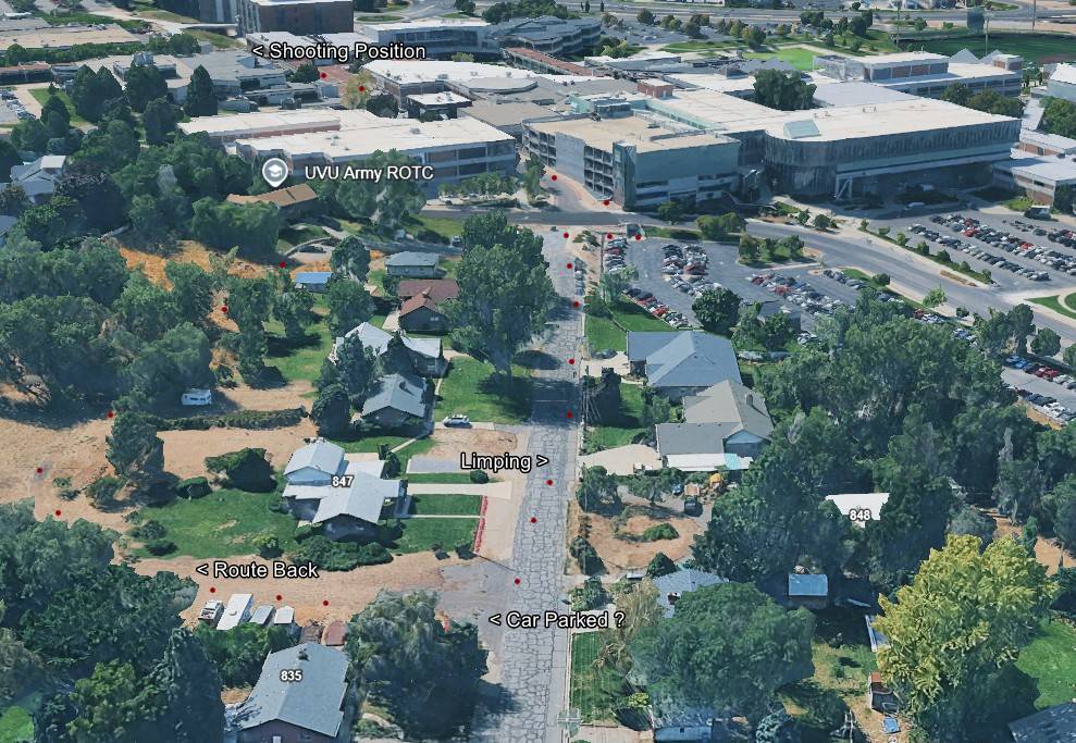
UVU's 158-page After-Action Report never once mentions the house UVU owns on the hill above the construction site, 691 W 925 S, even though the rooftop man's exit path ran right beside it and the rifle was found at the base of that hill. Who was in that house on September 10, and whose vehicles were parked in front, may be the single fastest way to crack open who really carried out Charlie Kirk's assassination. UVU holds the keys, the approvals, and the records, so we all need to ask UVU to release a "UVU House / Charlie Kirk Report".
Event core (courtyard complex)
| Feature | Investigative role |
|---|---|
| White canopy / tent | Stage where Charlie spoke; exploding mic theory |
| Courtyard lawn | Later paved over — Pavers, Hardscape |
| Audience bowl | Witness videos; Nick trajectory (shot from Kirk's right) |
| Walkways / tunnels | Affidavit approach path |
| Two locked metal doors | Set in the new pavers at the tent spot — Locked Metal Doors |
| Ingress gates | Metal detectors and bag checks per security gaps |
Detail page: UVU Courtyard.
Losee Center (east of courtyard)
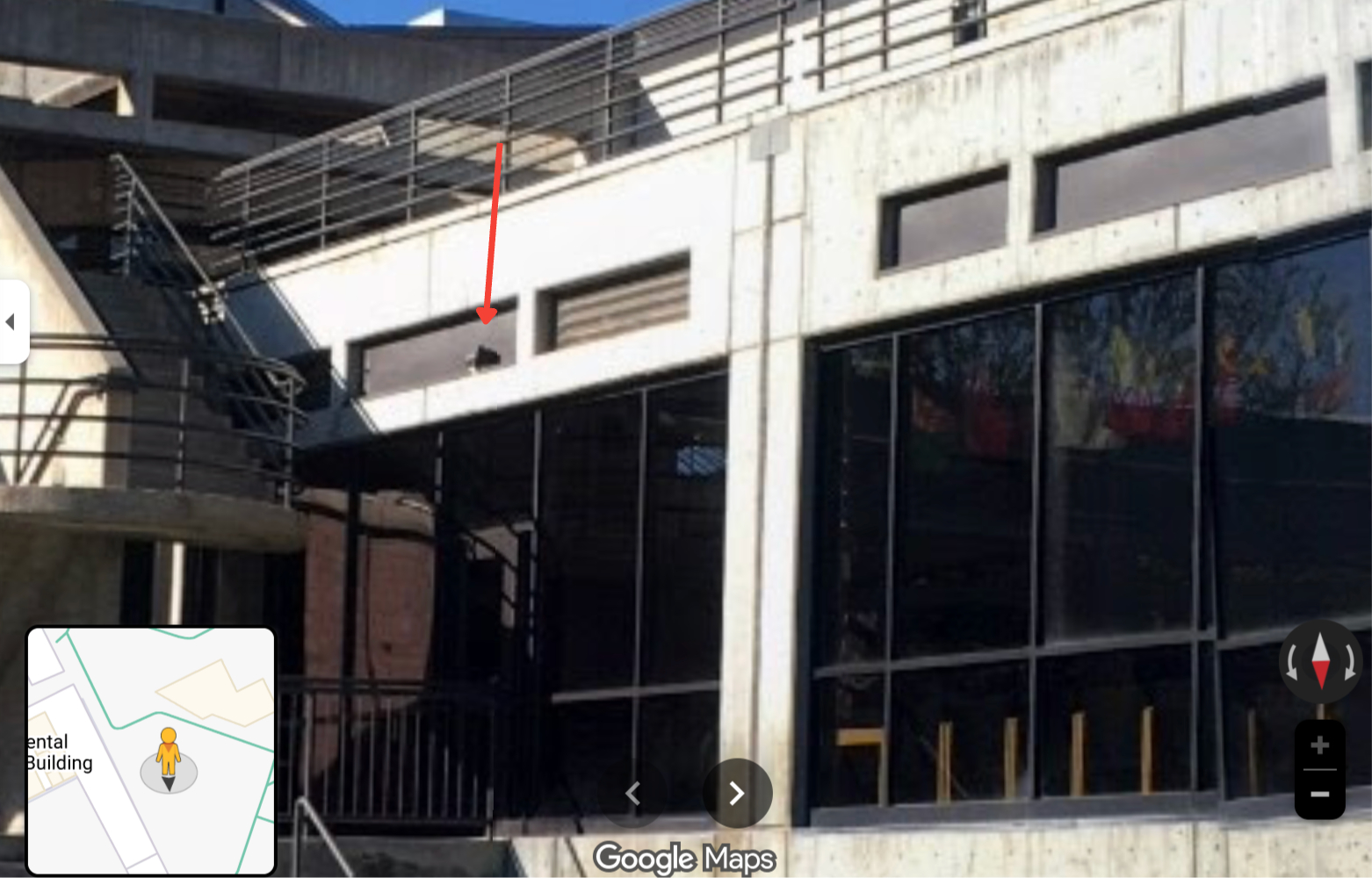
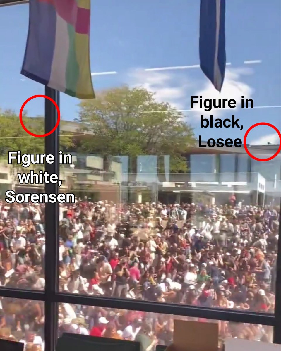
Charging documents allege the fatal shot originated from the Losee Center rooftop (~150 yards east). Investigators debate whether line-of-sight, audio, and witness accounts support that distance and angle — see Losee Center, Gun/Bullet — trajectory, and Proof Not Tyler. The rooftop shot is the government's narrative; most citizen investigators have concluded Charlie Kirk was killed by an explosive at his microphone.
Weeks after the shooting, Fox News published photos suggesting rooftop access paths remained obtainable.
Per the charging documents, the courtyard sits roughly 150 yards (about 430 feet / 130 meters) west of the Losee rooftop position, and one CK_FILE ballistics note argues a shot from that roof toward a crouching target would carry only a 5–9 degree downward angle.
Suspect's alleged route across campus (map-readable timeline)
The probable‑cause affidavit traces a path a reader can follow on a campus map. The individual described as "Suspect" — charged as Tyler Robinson, not convicted — appears in UVU surveillance summaries as follows:
| Time | Map landmark | Alleged movement |
|---|---|---|
| 08:29 a.m. | Campus entry | Gray Dodge Challenger arrival; maroon tee, light shorts, black hat — no backpack |
| ~11:50 a.m. | Grass north of Campus Drive / ~800 West | Southbound crossing; limp gait; black flag shirt in later frames |
| ~11:50+ a.m. | Parking lot → pedestrian tunnel under Campus Drive | South toward Losee |
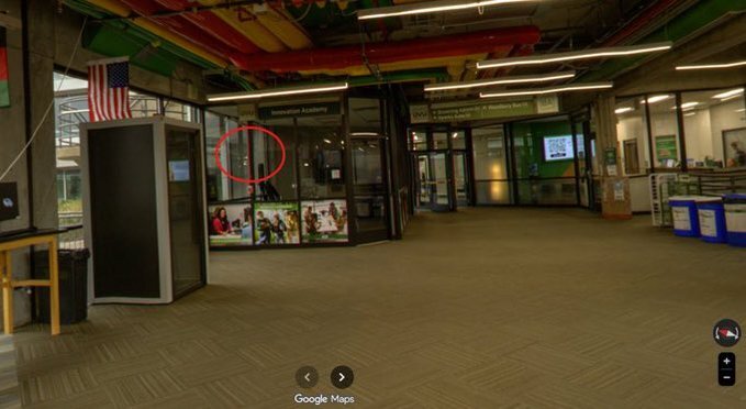
| ~12:02 p.m. | North side, Losee Center | Enter southeast-corner doors |
| 12:15–12:22 p.m. | Interior stairs → rooftop | Wall climb; prone west edge facing courtyard |
| ~12:23 p.m. | Courtyard line-of-sight | Shot fired at tent stage |
| ~12:23+ p.m. | Northeast corner → grass → north across Campus Drive | Escape toward wooded recovery area of alleged Mauser rifle |
These are allegations from the public filing, not proven facts. Compare Tyler Robinson — Stairs Guy for clothing and backpack mismatch threads.
People anchored to map positions (Sept 10)
| Person | Map anchor | Role |
|---|---|---|
| Hunter Kozak | Tent / Q&A line | Final audience question before shot |
| Rick Cutler | Behind stage, courtyard edge | Production crew |
| Terryl Farnsworth | Tent AV line | Sound crew — SD-card allegation unverified |
| Andrew Feraci | Feet from stage | TPUSA photographer |
| Charles McClintock Wilson | Courtyard press line | ZUMA final-moments stills |
| Caleb Chilcutt | Courtyard / chapter staff | UVU TPUSA president; event planner |
| Dylan Hope | 785 College Dr construction site | Perimeter witness — all-black clothing account; not Tyler per his reported statement |
Construction site adjacent to campus
A separate geographic thread points to a construction site next to the university at 785 College Dr, Orem, UT 84058. Electrician Dylan Hope — a witness reportedly working there — described seeing a man in all‑black tactical clothing, and CK_FILE notes he told officers the photo shown to the crew did not match the FBI's later public image. This location places a working eyewitness immediately adjacent to the campus perimeter. The account is a reported witness statement, not an adjudicated finding — see black-clothing suspect.
Tunnel and acoustic map points
The pedestrian tunnel under Campus Drive links the north parking zone to the courtyard's east side and appears in affidavit movement charts. Some audio analyses describe a ~4940 Hz left-channel signature near the courtyard edge — a near-field hypothesis distinct from a 150-yard rooftop source. Treat as contested research, not court findings.
Sound-analysis anchor point
For audio geolocation, CK_FILE identifies a Canon XA55 broadcast camera positioned roughly 46 meters from the tent, recording four uncompressed audio channels at 48 kHz. Its fixed distance makes it a useful anchor for researchers attempting to time‑align booms across the courtyard; see Mic overview and Courtyard. Analyses built on it are hypothesis tools, not court findings.
Regional context
| Location | Distance / note |
|---|---|
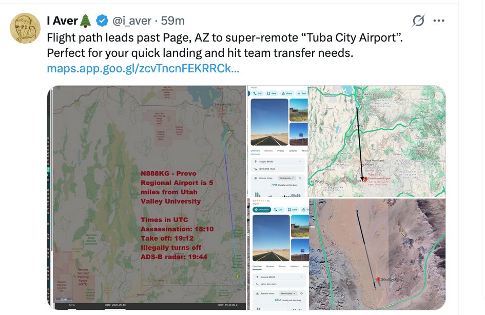
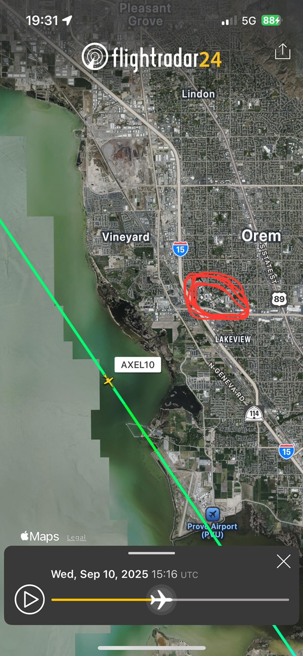
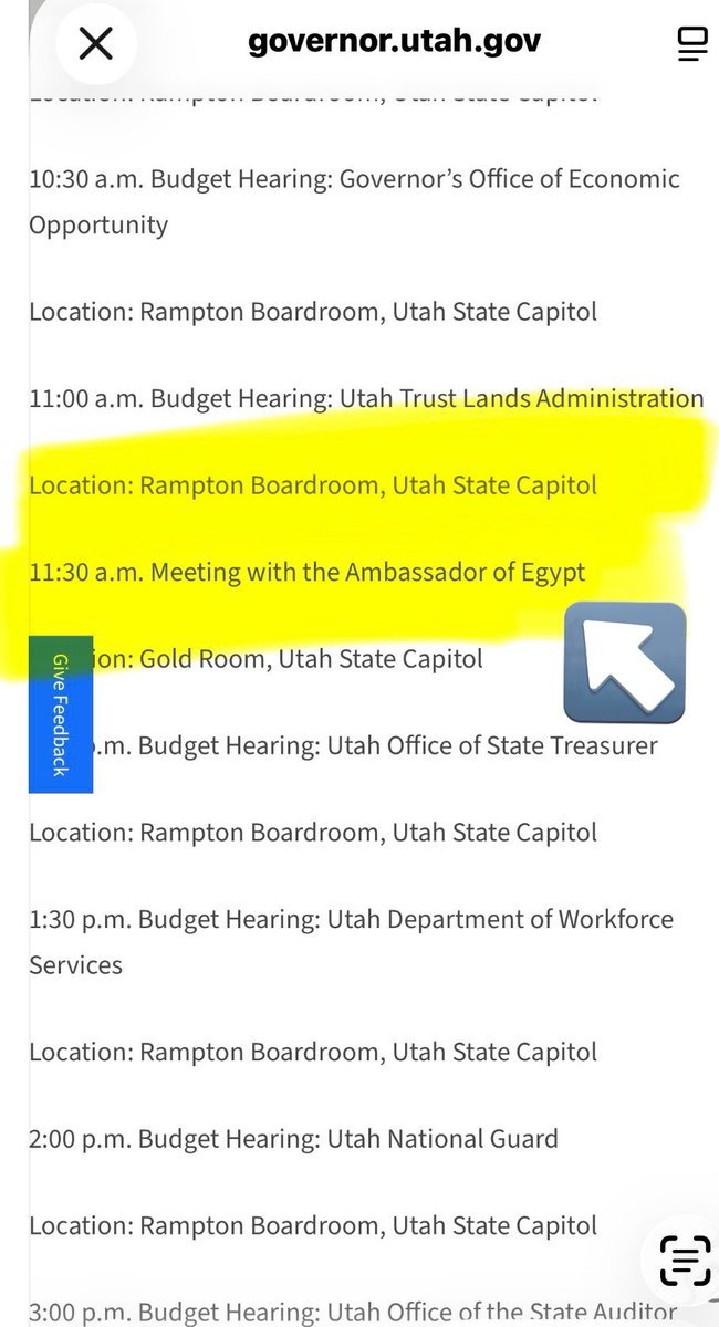
| Provo Municipal Airport (PVU) | ~7 mi — Egyptian jets, N102DZ |
| Utah Lake | N1098L low passes referenced relative to campus |
| Timpanogos Regional Hospital | ~5.8 mi — transport debate (Medical) |
| Utah Valley Hospital | ~4.2 mi — Level II trauma center |
| La Quinta Orem | Lodging tip for Egyptian crews |
Broader map resources
- Site-wide Maps section — regional and airport overlays
- Locations/Public Speaking Event — event permit context
- Drones — aerial footage over courtyard
- Photos — still images for geolocation
3D and trajectory work
Citizen researchers built 3D reconstructions testing multiple shooter positions and synchronizing audio/video (CK_FILE: sound-arrival-order analyses). Results are contested; use as hypothesis tools, not court findings.
Laws (Charlie Kirk)
Campus CAD drawings, rooftop-access logs, geofence warrant maps, and withheld surveillance feeds are among the records the Charlie Kirk Investigation Laws may compel.
Spatial Claims Citizen Investigators Plot
Maps shared on X typically mark: courtyard tent, Losee line-of-sight, south streets for Ring/WYZE paths, Provo airport / hospital corridors, and claimed drone/aircraft orbits. Pair cartography with Locations and Planes rather than treating any single viral map as authoritative.
Interesting In This Area
- The Losee Center sits east of the courtyard, across open ground.
- A construction site adjacent to campus appears in several investigation threads.
- Distances decide whether the tent or the roof matches the acoustics.
- The alleged route across campus is map-readable against security coverage.
Interesting In Other Areas
- The construction site at 785 College Drive borders the campus edge.
- The roof timeline reads differently once the distances are in front of you.
- The rifle was recovered in woods north of the campus.
- The site-wide map hub collects every geographic thread in the case.
Images
Other Pages In This Section
Losee Center (Alleged Sniper Rooftop)
The roof the government says the shot came from. Every part of it — line of sight, the lip, the drop, the screwdriver — has been measured by people who do not accept that account.
Read this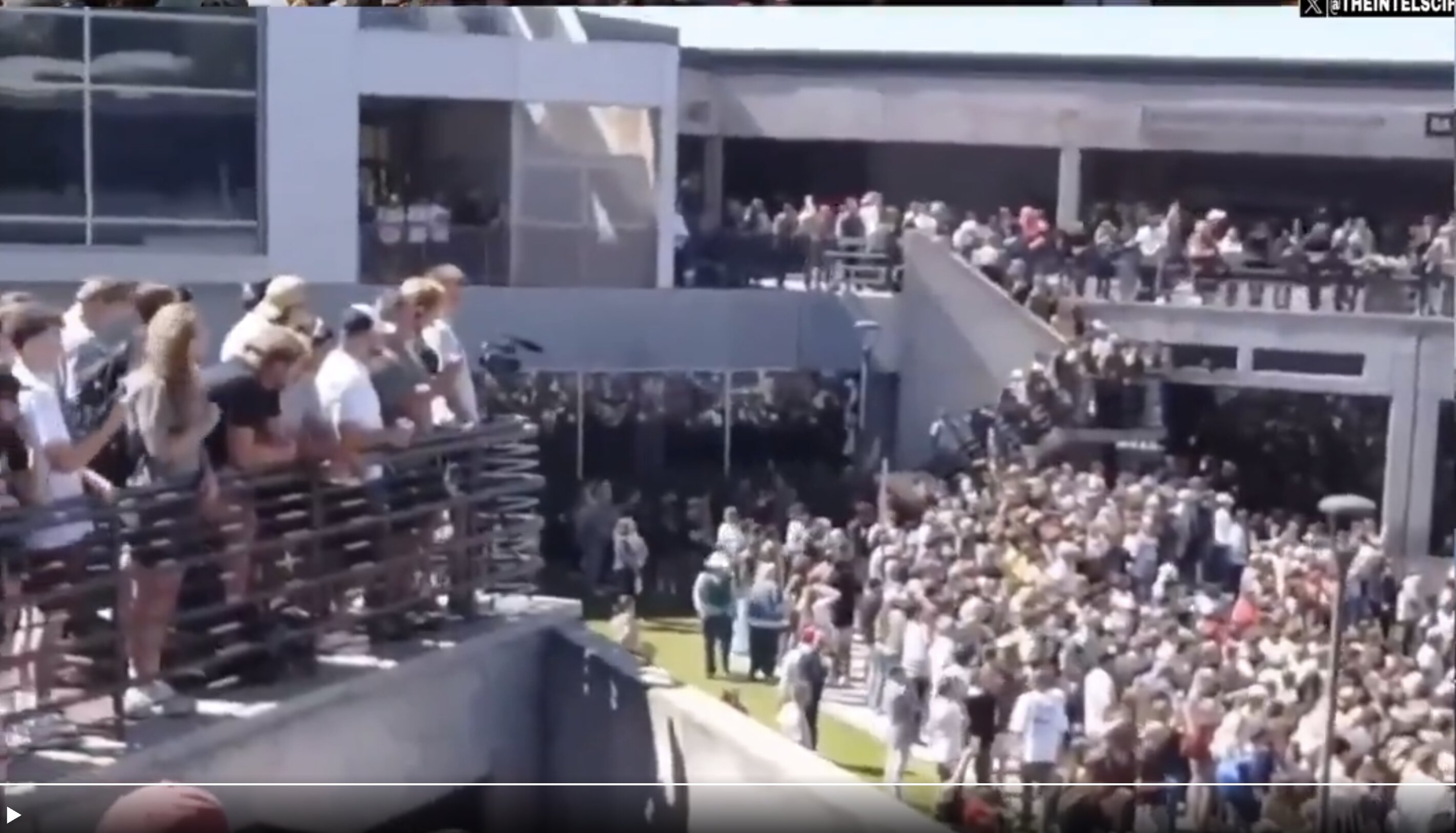
GRAMA records, undelivered warnings, emergency alerts and the university's handling of its own files — the institutional half of September 10. The same institution turns out to own the house north of campus.
Read this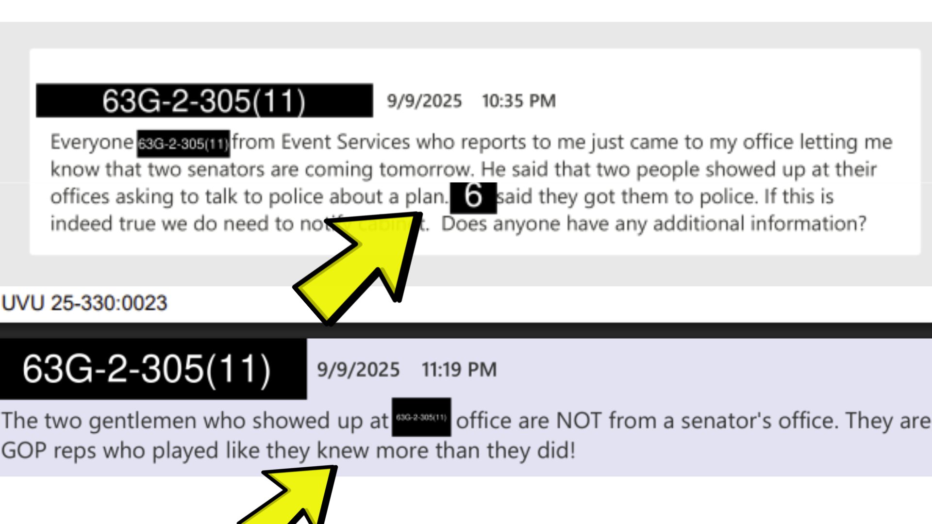
Pre-Shooting Warnings: Two Men Contacted UVU the Night Before
GRAMA records obtained by the Daily Caller News Foundation show two separate attempts to flag the event the day before — men asking police about "a plan," and a request that a message reach Charlie Kirk. Both were reportedly dismissed or left undocumented.
Read thisElsewhere In The Investigation
This website's author is @HolonCitizen on X and YouTube/@HolonCitizen. Follow me there.
Interesting
- Audio from 46 meters out reportedly holds three low-frequency booms, not one shot.
- Commentators say the rooftop figure performs a military lateral crawl with no limp.
- A figure in black reportedly sat on the Woodbury roof 20 minutes early.
Related Areas
- UVU campus surveillance
- Tyler Robinson — Sept 10 timeline
- Proof Not Tyler — overview
- Site-wide maps hub
- Drones over UVU