Tyler Robinson Travel
Overview
This document contains information about Tyler Robinson's travel patterns and movements related to the Charlie Kirk incident.
Topic
Topic: Claimed travel routes and movements of Tyler Robinson before and after the incident, and questions about timing and logistics.
Reported movements on 10 September 2025 (claimed)
Publicly discussed doorbell, traffic, and campus surveillance footage has been used by media outlets and online investigators to outline Robinson’s movements on the day of the incident. Each sighting below is tied to a specific camera — see Surveillance Cameras for the device-by-device breakdown (Ring, WYZE, UVU surveillance) and Tyler as a Placeholder Figure for the clothing-mismatch question. A commonly cited timeline (based on those sources) includes:
- Morning (pre‑event)
- 8:07 a.m. – Walking on S 800 W toward campus (Ring camera; maroon shirt and light‑colored shorts).
- 8:23 a.m. – Driving on W 880 S (WYZE camera).
- 8:29 a.m. – Driving on campus (UVU surveillance).
- 9:57 a.m. – Walking on W 880 S (WYZE camera).
- Late morning (outfit change)
- Commentary notes a reported outfit change to jeans and a long‑sleeve shirt between 10:00 and 11:30 a.m.
- 11:44 a.m. – Walking on W 800 S (Ring camera).
- 11:49 a.m. – Walking on S 800 W toward campus (Ring camera).
The shooting itself is generally placed at 12:23 p.m. MDT, with some reports referencing 12:27 p.m., and police audio suggesting a first radio call at about 12:26 p.m. These discrepancies are a core focus for investigators questioning the official timeline.
Rifle drop‑off and route questions (claims)
News reports and commentary on the case state that:
- The rifle attributed to Robinson—a scoped .30‑06 belonging to a family member—was recovered in or near bushes close to the university after the incident, with DNA on the weapon reported to match Robinson.
- Some analyses reference a map published in media that marks locations such as the “rifle found” point and a nearby construction site, where workers reportedly encountered a person dressed in black they initially believed might be the gunman, before later being told the person did not match Robinson’s appearance.
- Investigators and commentators ask whether there was sufficient time for Robinson to:
- Leave the rooftop,
- Move across campus or nearby areas,
- Stash or abandon the rifle,
- Change clothes, and
- Travel on to later‑reported locations.
These are presented as questions and analytical challenges to the official narrative, not as definitive proof of an alternative account.
Dairy Queen stop and return to St. George (claims)
Several media segments and social‑media posts, including those shared by commentators such as Candace Owens, describe a claimed sighting of Robinson at a Dairy Queen in Orem:
- The location is typically given as 813 E 800 N, Orem, Utah 84097, about a 15–20 minute drive from the UVU campus under normal traffic.
- Time of the sighting is often cited as 6:38 p.m. MDT, with still images showing a person alleged to be Robinson wearing a maroon shirt, blue jeans, hat, and sunglasses, appearing calm.
- Based on this, investigators pose questions such as:
- What route did he take from UVU to the Dairy Queen?
- How long did he stay there, and who (if anyone) accompanied him?
- How did he travel from Orem back to St. George, and when did he arrive?
- Are there additional license‑plate, toll, or camera records for vehicles used on that route?
These questions are part of the broader challenge to reconstruct a complete and verifiable travel timeline for the hours after the shooting.
Dairy Queen timing dispute (claim)
The master investigation file records two competing times for the Dairy Queen sighting, and the discrepancy is itself a focus of the investigation:
- One reconstruction cites 12:38 p.m. MT — about 15 minutes after the shooting — noting the Dairy Queen is roughly a 15–17 minute drive from campus and asking how that leaves time to "get off the roof, walk, hide the gun in the forest, change clothes twice, and disassemble the gun."
- The more widely circulated figure is 6:38 p.m. MT, roughly six hours after the shot, tied to the still image Candace Owens reportedly released.
Both cannot describe the same event cleanly, and investigators treat the unresolved timestamp as a reason to demand the original, timestamped CCTV.
Drive south on September 11–12, 2025 (as reported)
News coverage summarized in Charlie_Kirk.txt describes the overnight drive back toward southern Utah:
- Robinson was reportedly captured on surveillance at a Maverik gas station in Cedar City, Utah, around 7:15–7:17 a.m. on September 11, driving the gray Dodge Challenger, paying at the pump with a credit card, and leaving without approaching any trash cans (authorities had been alerted to check for dumped evidence). Cedar City is about 215–250 miles south of the scene, directly on I-15. (Fox News)
- The file states there was no reported stop at his apartment; police separately secured both the parents' home in Washington City and the St. George apartment after the surrender was arranged.
- On the evening of the 11th, a retired Washington County detective (a family friend) reportedly drove Robinson and his parents from the parents' home directly to the Washington County Sheriff's Office, 620 S 5300 W, Hurricane, UT 84737; he was later transported to the Utah County Jail, 3075 N Main St, Spanish Fork, UT. (police1.com, ABC News)
"Drop the clothes" patsy claim (reported)
The file preserves a reported claim attributed to Candace Owens that reframes the entire travel narrative: that Robinson "is the patsy. He never even stepped on that campus. His only 'job' was dropping clothes by a Dairy Queen and cemetery to frame him." It also notes a related report that construction workers near campus encountered a person in all black they initially thought was the gunman, and were shown a law-enforcement photo that reportedly did not match Robinson. These are attributed allegations, not verified facts, and are included to show the alternative travel theory investigators are testing.
Open questions and further evidence needs
To clarify Robinson’s travel and movements, investigators continue to call for:
- Full, timestamped release of relevant Ring, WYZE, and UVU campus footage showing his movements to and from campus.
- Any traffic, parking, or roadway cameras capturing vehicles associated with Robinson between Orem and St. George.
- Detailed cell‑tower and location data, where legally obtainable, to cross‑check claimed sightings and travel times.
- Clarification of the exact time of the shot, and synchronized comparison with camera footage and dispatch records.
Until such primary‑source material is comprehensively disclosed and independently reviewed, the travel narrative remains partly reconstructed from media reports and citizen‑investigator analyses, and should be treated accordingly.
Laws (Charlie Kirk)
- Cell tower and CSLI data tracing the Orem‑to‑St. George route and license‑plate and roadway camera records for vehicles used and the full timestamped Ring, WYZE, and UVU footage are things that the Charlie Kirk Investigation Laws may result in powerful truths coming out that aren't out yet.
Travel / Camera Chain Claims on X
Neighborhood and merchant camera discourse remains active:
- Ring frames at 8:07 / 11:44 / 11:49 MDT on S 800 W / W 800 S bookend the morning walk narrative.
- Baron Coleman shadow-analysis claims (investigative notes) dispute a 9:00 a.m. doorbell timeline versus sun angles — analytical claim, not a court finding.
- Evening merchant frames (Dairy Queen ~6:38 p.m.; Cedar City Maverik Sept 11) feed long-distance travel questions after the event.
See Ring and Merchant CCTV.
Best understanding of when this happened
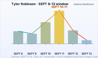
Best understanding: public Robinson timeline claims concentrate in SEPT 8–13, with heavy mass on day-of (SEPT 10) and surrender chain (SEPT 11). Chart is that week only.
Date range (working model): SEPT 8–13 · Day-of + surrender neighborhood
The chart below is not a government finding. Bar height is relative likelihood from public claims. Domain is trimmed to non-trivial likelihood.
Interesting In This Area
- Two Dairy Queen times circulate, 12:38 PM and 6:38 PM, unreconciled.
- A restaurant check three hours south is timestamped 8:55 to 9:47 PM.
- One reconstruction totals 13 hours of driving in a single waking day.
- The gray Dodge Challenger sits at the centre of the surrender chain.
Interesting In Other Areas
- The Orem Dairy Queen is a fifteen to twenty minute drive from campus.
- Sighting by sighting, the camera chain runs Ring, WYZE and campus surveillance.
- A Panguitch identification would break the night-of timeline entirely.
- The camera timeline collects each timestamped frame in order.
Other Pages In This Section
The proceeding rests on a premise this site treats as unsettled — a rifle round from a roof rather than a device at the lectern. The page routes to the sworn record: who testified, what they said, and which bench decides what stays sealed.
Read this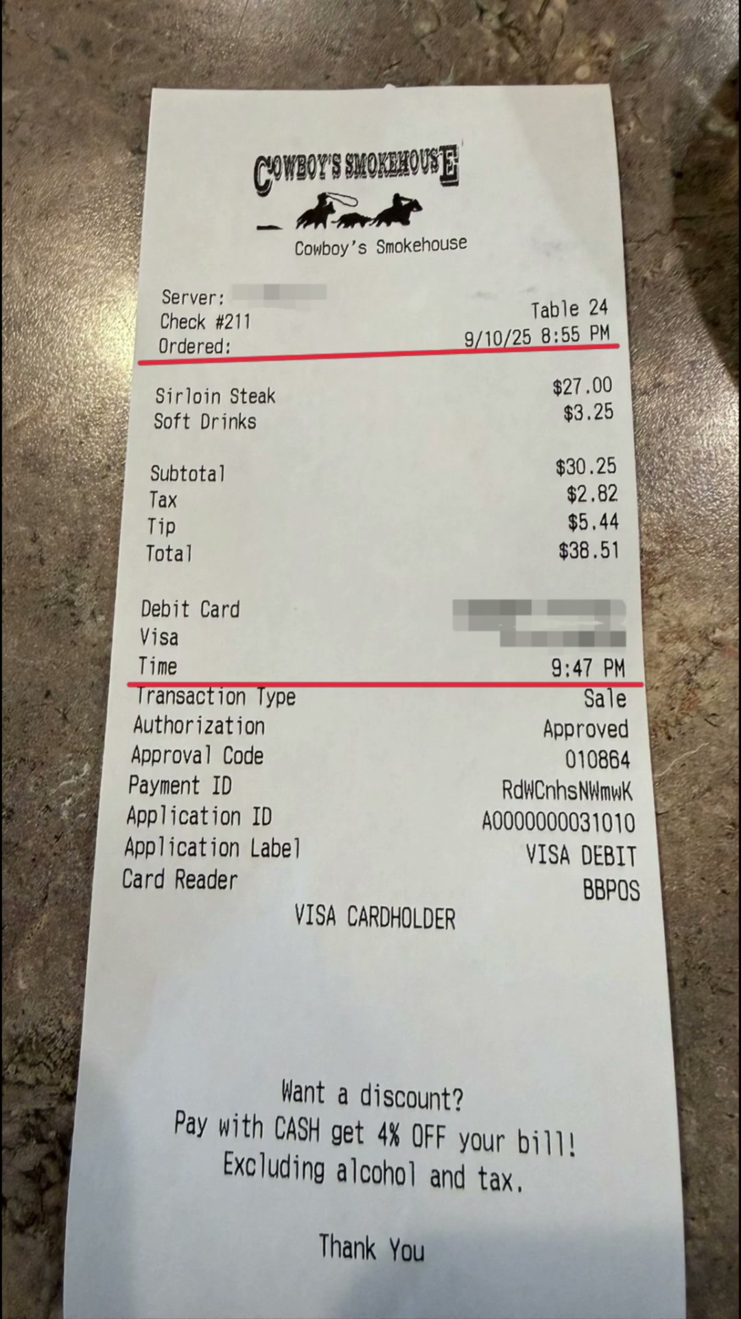
Check 211, Table 24, ordered 8:55 PM and paid at 9:47 PM on 9/10/25, total $38.51. Citizen investigators circulate it as an alibi; the paper names no diner, which is exactly why the last four digits of the card matter.
Read this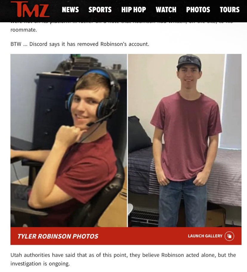
Discord Removed the Account That Posted It
The account was deleted. Deletion is what takes the login history, the device fingerprints and the IP records out of reach of anyone without a subpoena.
Read thisEvery Discord artifact in the case in one place: the confession screenshot, the usernames, the servers, the company's own denials, and the warrant trail. Robinson is charged, not convicted.
Read thisElsewhere In The Investigation
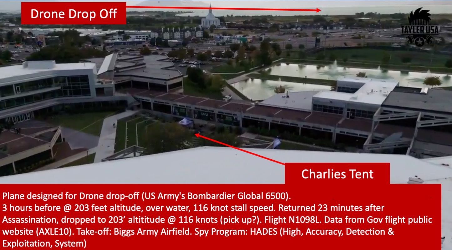
Dairy Queen — Orem (813 E 800 N)
Six hours after the shooting the accused was reportedly on restaurant CCTV at 6:38 PM, calm, seventeen minutes from campus. Timeline builders use the pin to test whether the affidavit's movement chain actually closes.
Read this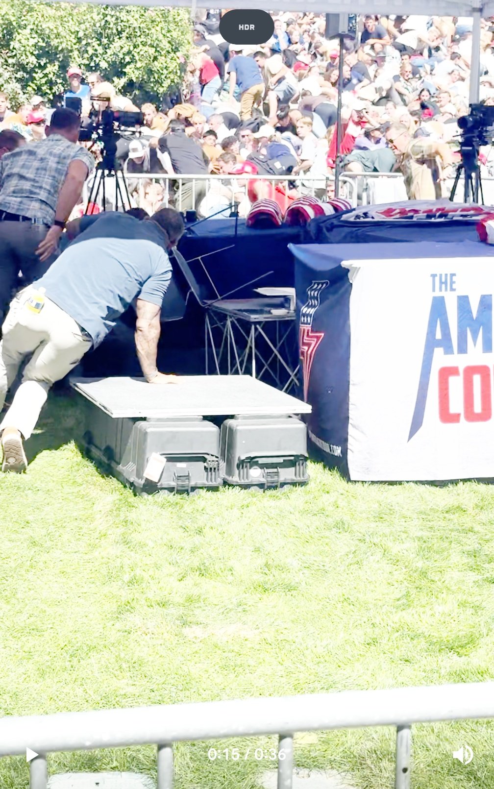
Every camera sighting the released timeline attributes to the charged man on September 10 and 11, hour by hour. Cameras record movement, not names — which is exactly the gap the identity dispute lives in.
Read thisSurveillance Cameras: Tyler Robinson Sightings Timeline
Every timestamped frame the released timeline attributes to the charged man across September 10–11 — doorbell captures, campus cameras, the stairwell stills. Cameras record movement, not names, which is where the identity dispute lives.
Read this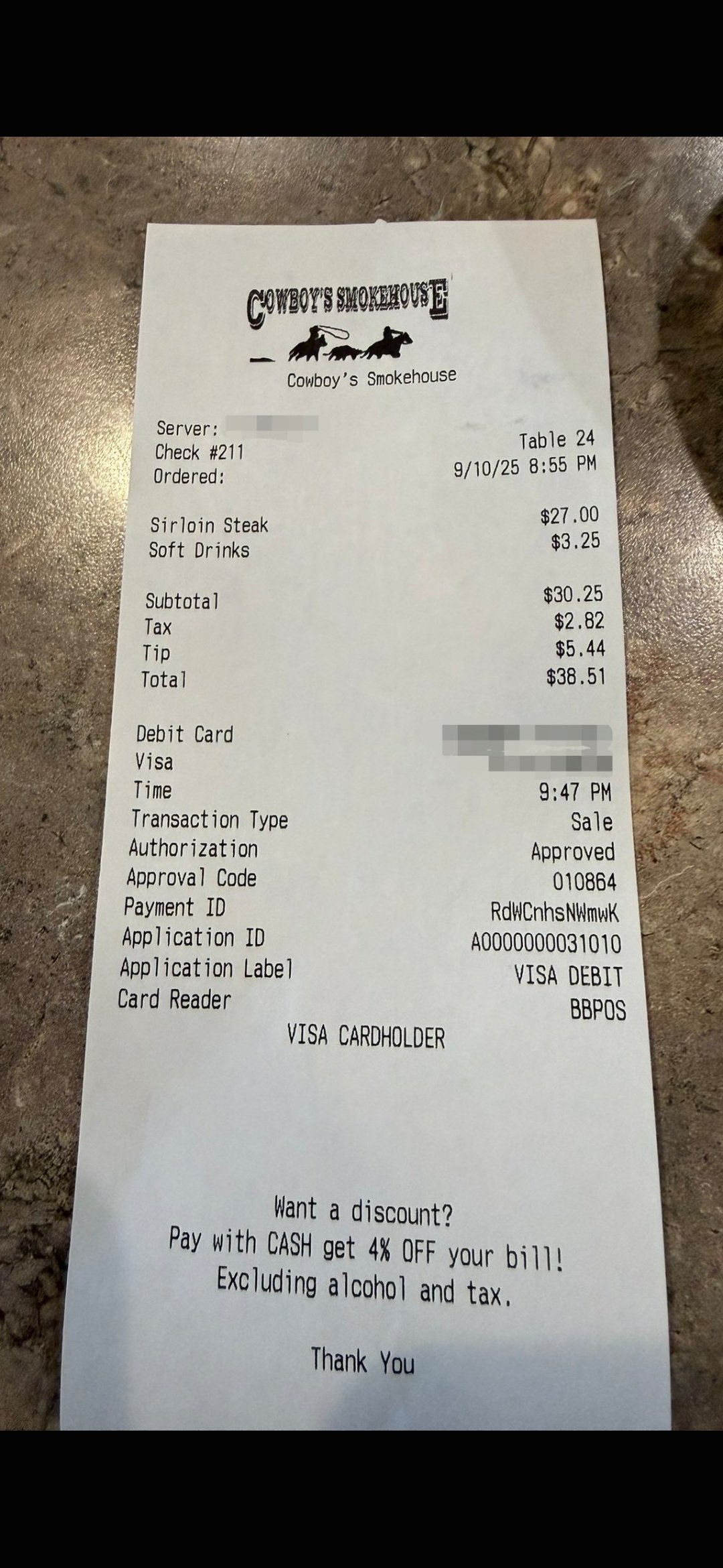
Panguitch — The Town That Breaks the Timeline
Restaurant staff 209 miles south of Orem say they served the accused dinner from 8:55 to 9:47 PM that night, and gave the FBI the last four digits of the card. The server says nobody ever came back.
Read thisThis website's author is @HolonCitizen on X and YouTube/@HolonCitizen. Follow me there.
Interesting
- Family text messages reportedly point the other way, per Baron Coleman.
- Impressions collapse the moment ballistics come up — see deboosting of investigators.
- One user's narrative poll reportedly would not post at all — see the blocked X poll.
Related Areas
Images